Understanding which Seattle intersections consistently generate serious accidents, why these locations remain dangerous despite improvement efforts, what evidence you must preserve immediately after intersection collisions, and how to navigate the complex liability landscape when crashes occur at locations where multiple factors conspire to create unavoidable accidents that insurance companies blame entirely on you
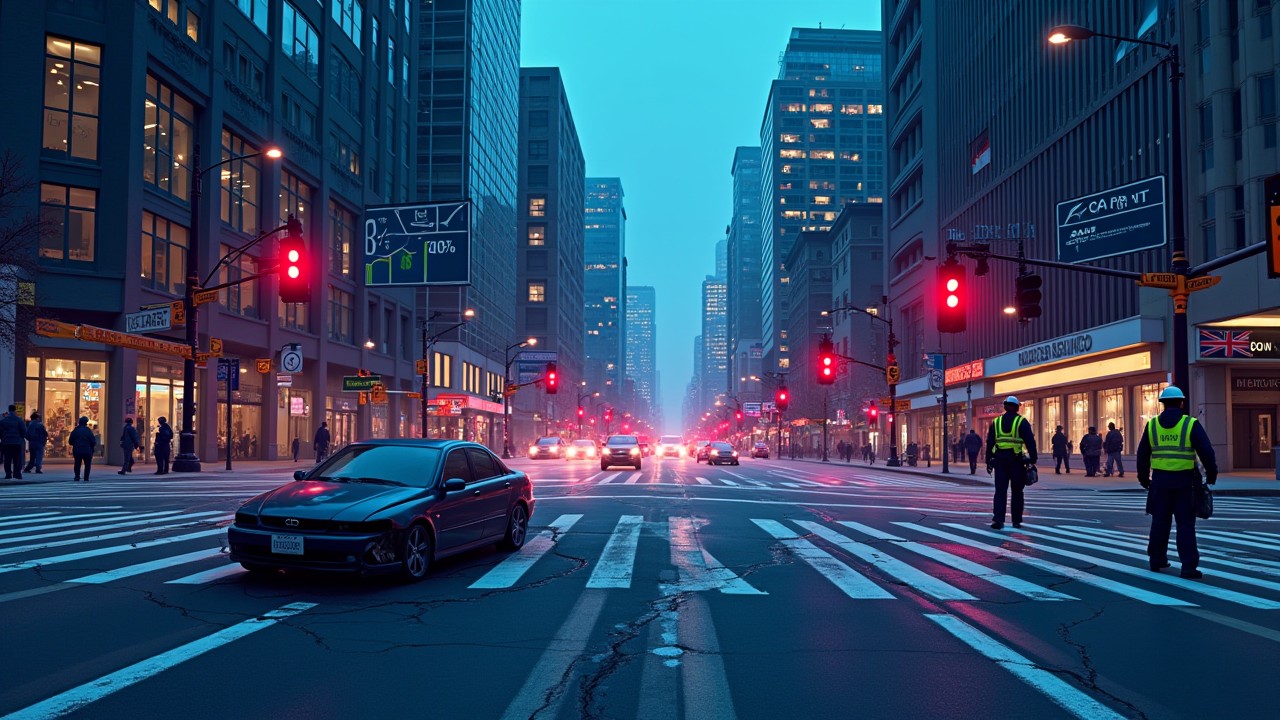
You were driving through downtown Seattle during your commute, approaching the intersection of James Street and 6th Avenue like you have hundreds of times before, when suddenly a vehicle ran the red light from your left while a pedestrian stepped into the crosswalk from your right and another driver behind you followed too closely to stop when you braked to avoid the pedestrian, creating a three-vehicle collision that left you with serious injuries, a totaled car, and immediate questions about who bears responsibility when multiple parties’ actions converged simultaneously at an intersection that has topped Seattle’s dangerous intersection rankings for years with eighty-eight injury-causing accidents in 2022 alone. Now you are sitting in Harborview Medical Center receiving treatment for injuries that will affect your life for months or years, facing insurance adjusters who will argue that you should have anticipated the chaos that this intersection creates despite the fact that even the most careful drivers cannot predict when multiple simultaneous violations will occur at locations where poor design, confusing traffic patterns, and high pedestrian volumes create genuinely hazardous conditions. The investigating officer noted on the police report that this intersection is “known for accidents” and cited multiple contributing factors, notations that sound like neutral observations but that insurance companies will weaponize to argue that you should have driven more cautiously through an area you had no reason to know was particularly dangerous until the moment multiple vehicles and pedestrians created an unavoidable collision scenario. This situation plays out daily across Seattle’s most dangerous intersections as the city’s unique geography, complex traffic patterns, and explosive urban growth create collision hotspots where even experienced local drivers suffer accidents that leave them fighting insurance companies more interested in denying claims than in acknowledging how infrastructure failures and design defects contribute substantially to crashes that careful driving cannot always prevent.
Understanding how to protect yourself after accidents at Seattle’s dangerous intersections requires building comprehensive knowledge systematically about several interconnected realities that most drivers never appreciate until collisions force recognition that certain locations present extraordinary risks requiring specialized legal approaches. First, we need to understand exactly which Seattle intersections consistently generate the highest accident rates and what specific characteristics make these locations particularly hazardous, characteristics including geometric complexity where multiple roads converge at odd angles, visibility limitations created by hills and urban development, pedestrian volumes that overwhelm infrastructure designed for different use patterns, and traffic signal timing that fails to provide adequate gaps for safe movements. Second, we must examine why these dangerous intersections persist despite various improvement efforts and despite widespread knowledge among local drivers that certain locations present elevated risks, persistence that reflects the challenging reality that urban infrastructure cannot always be retrofitted adequately to address problems created by historical planning decisions, topographic constraints, and land use patterns established decades before current traffic volumes developed. Third, we need to explore the complex liability landscape that intersection accidents create, landscape where multiple parties potentially bear responsibility including drivers who violated traffic rules, the City of Seattle for infrastructure design or maintenance failures, and even pedestrians or cyclists whose actions contributed to collision sequences even though they suffered the most serious injuries. Fourth, we must develop sophisticated understanding of what evidence proves essential for intersection accident claims and how to preserve this documentation immediately before conditions change and before insurance companies construct narratives that shift maximum blame onto you regardless of how multiple parties’ actions actually contributed to collisions. Throughout this exploration, think of yourself as building the awareness necessary to navigate Seattle’s most dangerous intersections safely while also understanding how to protect your legal rights when accidents occur at locations where infrastructure failures and other drivers’ negligence create hazards beyond your ability to avoid through reasonable caution alone. The Seattle Department of Transportation maintains data about traffic safety and intersection improvements that helps contextualize the challenges these locations present.
The Foundation: Understanding Seattle’s Intersection Safety Crisis
Before we can effectively navigate the specific dangers of Seattle’s worst intersections and understand how to protect yourself legally after accidents occur, we must establish clear understanding of the broader traffic safety trends that explain why certain intersections have become persistent collision hotspots despite the city’s overall reduction in total accident numbers. This foundation proves essential because it reveals the paradoxical reality that Seattle’s streets are simultaneously becoming safer in some ways while more dangerous in others, a contradiction that requires sophisticated analysis to understand and that insurance companies exploit by focusing only on the statistics that support their agenda of minimizing claim payments. Let me walk you through Seattle’s current traffic safety landscape so you understand the complex environment in which intersection dangers exist and persist.
The Accident Reduction Paradox: Fewer Crashes But More Deaths
Seattle’s traffic safety data reveals a troubling paradox that demands careful interpretation to understand what is actually happening on the city’s streets and intersections. Car accidents in Seattle have decreased dramatically by fifty percent from 2015 to 2024, dropping from 14,483 reported accidents in 2015 to just 7,312 in 2024, a reduction that initially suggests major progress in traffic safety that should be celebrated as evidence that road improvements, vehicle technology advances, and changing driving patterns have made Seattle substantially safer. However, this encouraging headline statistic conceals a devastating countertrend that reveals the complexity of urban traffic safety and that explains why knowing about dangerous intersections becomes more rather than less important despite overall accident reductions. Fatalities have risen sharply by ninety percent from 22 deaths in 2015 to 38 in 2024, meaning that while crashes occur less frequently, those that do happen prove far more likely to result in deaths rather than survivable injuries. This pattern suggests that fundamental changes in how Seattle accidents occur have made surviving collisions more difficult even though avoiding accidents entirely has become somewhat easier for drivers who navigate the city carefully.
To help you understand exactly what drives this paradox and why it matters for intersection safety specifically, let me explain the multiple factors that contribute to fewer total accidents coinciding with more deadly outcomes. The accident reduction reflects several positive developments including improved vehicle safety technology with automatic emergency braking, lane departure warnings, and blind spot detection systems that prevent many collisions that older vehicles would have experienced. Changes in driving patterns influenced by remote work trends that began during COVID-19 have reduced overall traffic volumes during traditional rush hours, creating less congestion and fewer opportunities for the fender-benders and minor collisions that previously inflated total accident statistics. Additionally, traffic calming measures, improved signal timing, and better road design at many locations have successfully reduced accident rates where these improvements have been implemented systematically. However, the fatality increase reveals darker trends that overwhelm these safety improvements in severity if not in frequency. Less congested roads create opportunities for higher speeds that prove deadlier when collisions do occur, as vehicles traveling at sixty miles per hour in crashes that would have occurred at forty miles per hour in heavier traffic generate dramatically more kinetic energy and cause correspondingly more severe injuries and deaths. The growing popularity of larger vehicles including SUVs and pickup trucks means that when collisions occur, the mass differentials between vehicles create more dangerous impact forces, particularly for smaller vehicles, pedestrians, and cyclists who suffer disproportionately when struck by heavy trucks traveling at high speeds. More aggressive driving behaviors including distracted driving from smartphone use, road rage incidents, and impaired driving despite increased awareness campaigns all contribute to collision severity when accidents occur. Finally, infrastructure improvements have focused on some locations while others have received minimal attention, creating situations where the most dangerous intersections continue generating serious accidents even as citywide averages improve through safety gains at better-designed locations. This paradox explains why understanding specific dangerous intersection locations proves more important than ever, because while you are less likely to have an accident during any particular trip through Seattle, the accidents that do occur prove more likely to cause serious injuries or death, making identification and avoidance of the highest-risk locations a critical safety strategy. Information about Seattle’s traffic safety trends can be found through the SDOT Blog which publishes regular updates about city transportation safety initiatives and statistics.
| Year | Total Reported Accidents | Traffic Fatalities | Severity Trend |
|---|---|---|---|
| 2015 | 14,483 | 22 | Baseline year; high accident volume but lower fatality rate |
| 2020 | 9,847 | 26 | COVID impact; reduced traffic but increased speeds and severity |
| 2022 | 8,156 | 34 | Continued decline in total crashes; accelerating fatality increases |
| 2024 | 7,312 | 38 | 50% fewer accidents than 2015 but 73% more deaths |
| 2025 (Jan-Mar) | 29 reported | 1 (plus 16 injuries) | Early-year numbers; trend continuing with severity concerns |
Three-Year Crash Data: The Comprehensive Picture of Seattle’s Intersection Dangers
Recent comprehensive data covering the three-year period from June 20, 2022 to June 19, 2025 provides the most detailed picture yet of how Seattle’s intersections function as collision hotspots that generate devastating injuries and deaths despite overall improvements in citywide traffic safety statistics. SDOT’s newly unveiled interactive traffic crash, volume and intersection analysis dashboard reveals that during this three-year period, Seattle experienced 19,227 crashes resulting in 7,822 injuries and 87 fatalities, numbers that translate to more than seventeen crashes per day, seven injuries per day, and one death approximately every thirteen days. These statistics demonstrate that despite reductions from peak accident years, Seattle’s streets and intersections continue generating serious accidents at rates that demand attention and that create substantial personal injury liability for drivers, property owners, and municipal entities whose negligence contributes to these collisions. The dashboard represents a significant transparency advance that allows residents, researchers, and advocates to examine traffic patterns and crash data at granular levels never before accessible to the public, providing tools for identifying dangerous intersections in your own neighborhoods and for understanding exactly what types of accidents occur at specific locations.
To help you understand how to use this data practically for protecting yourself and for supporting potential injury claims after accidents, let me explain what the dashboard reveals about intersection dangers and how this information translates into actionable safety strategies and legal evidence. The dashboard includes crash analysis providing an inventory of all collision records from the Seattle Police Department, road segment counts showing vehicle volumes at specific locations throughout the city, and intersection counts documenting the number of people turning and crossing at key intersections, data that collectively reveals not just where accidents occur but why certain locations generate disproportionate crash rates. The crash data breaks down by severity level allowing you to distinguish between property-damage-only accidents, injury crashes, and fatal collisions, distinctions that prove essential for understanding which intersections present the greatest risks for serious harm rather than just minor fender-benders. Geographic mapping features allow visualization of crash clusters showing how certain intersections function as collision magnets drawing accident reports far exceeding what random distribution would predict. Time-based analysis reveals when dangerous intersections experience peak accident rates, information valuable for route planning that avoids high-risk locations during their most dangerous periods. Additionally, the dashboard provides demographic data about crash victims and contributing factors including speeding, impaired driving, distracted driving, and pedestrian or cyclist involvement, information that helps explain why certain intersections become particularly dangerous and what behaviors most commonly contribute to collisions. This comprehensive data transparency serves multiple purposes including empowering residents to make informed travel decisions, supporting advocacy for infrastructure improvements at demonstrably dangerous locations, and providing objective evidence for personal injury claims when accidents occur at intersections where documented crash histories establish that dangers existed before your collision. If you are injured at a Seattle intersection, accessing this dashboard data immediately after your accident provides powerful evidence that the location presents known hazards, that the city had notice of dangerous conditions, and that your accident represents part of a pattern rather than an isolated incident resulting solely from your alleged negligence. Resources for understanding traffic safety data can be found through urban planning organizations and through publications explaining how crash statistics inform infrastructure improvement priorities.
Using Crash Data to Strengthen Your Injury Claim: One of the most powerful ways to support your personal injury claim after an intersection accident involves documenting through SDOT’s crash database that the location where you were injured has an established history of similar accidents, evidence that helps prove the intersection presents known dangers that the city failed to address adequately and that other drivers should have recognized required extra caution. Insurance companies consistently argue that accidents result from individual driver negligence rather than from systematic infrastructure failures, but comprehensive crash data showing that dozens or hundreds of previous accidents occurred at the same location undermines these arguments by demonstrating that the intersection itself creates hazards beyond what reasonable driving can always avoid. When preparing your claim, access the dashboard immediately to download complete crash histories for your accident intersection including total accidents, injury counts, fatality numbers, and specific contributing factors documented in previous collision reports. Print or save this data permanently as it provides objective third-party evidence that cannot be characterized as self-serving since it was collected independently of your accident. Present this documentation to insurance adjusters during negotiations, emphasizing that your accident represents a predictable outcome of known dangerous conditions rather than an isolated incident caused entirely by your alleged negligence. If your case proceeds to litigation, this data supports expert testimony about intersection design defects and municipal liability claims against Seattle for failing to correct hazards that crash statistics revealed required attention. The dashboard’s public accessibility means that retrieving this evidence costs nothing and requires no specialized legal process, making it one of the most valuable and easily obtained types of supporting documentation for intersection accident claims.
Seattle’s Most Dangerous Intersections: Detailed Hazard Analysis
Having established the broader context of Seattle’s traffic safety trends, we can now examine the specific intersections that consistently generate the highest accident rates and that represent the greatest risks for serious injuries when collisions occur. Understanding these locations proves valuable both for avoiding them when practical and for understanding what legal claims might exist when accidents inevitably occur despite your best efforts to navigate these hazardous areas safely. Let me walk you through Seattle’s most dangerous intersections systematically, explaining not just where they are located but why they remain persistently hazardous and what specific risks they present.
James Street and 6th Avenue: Seattle’s Deadliest Intersection
James Street and 6th Avenue has continuously topped Seattle’s dangerous intersection rankings for years, with eighty-eight injury-causing accidents in 2022 alone and an estimated 101 injury crashes since 2004, making it twenty-eight accidents more dangerous than the next most hazardous intersection and establishing it definitively as the single most dangerous location for Seattle drivers, pedestrians, and cyclists navigating the city’s downtown core. This intersection’s consistent appearance at the top of danger lists reflects multiple converging factors that create a perfect storm of collision risks that persist despite awareness of the location’s hazards and despite various improvement attempts that have failed to reduce accident rates to acceptable levels. The intersection sits in downtown Seattle’s densest area near the King County Courthouse and justice complex, creating unusual traffic patterns as legal professionals, court visitors, jurors, defendants, witnesses, and general downtown traffic all converge on a relatively small geographic area where parking is scarce and where many drivers unfamiliar with downtown Seattle’s one-way street patterns struggle to navigate to their destinations. The area’s steep topography creates visibility challenges where vehicles approaching from uphill directions may not see pedestrians or other vehicles until they are already in the intersection, while downhill approaches generate momentum that makes stopping difficult when unexpected hazards appear suddenly.
To help you understand exactly why James and 6th remains so dangerous and what specific hazards you face when navigating this intersection, let me explain the detailed mechanics of how this location generates its extraordinary accident rate. The one-way street configuration creates confusion for drivers unfamiliar with downtown Seattle’s grid pattern, as James Street runs one-way eastbound at this location while 6th Avenue runs one-way southbound, meaning that drivers approaching from certain directions must take circuitous routes to reach destinations that appear to be straight ahead, creating situations where frustrated drivers make illegal turns or sudden maneuvers attempting to correct navigation errors. Pedestrian volumes overwhelm the infrastructure at this location as courthouse visitors, government workers, and downtown commuters cross in high densities during business hours, creating situations where crosswalk signals provide inadequate time for all pedestrians to complete crossings before vehicle signals turn green. The proximity to the courthouse generates unique pedestrian behavior patterns as anxious defendants, stressed attorneys rushing between hearings, and jurors unfamiliar with downtown traffic patterns cross streets while distracted by legal concerns rather than focusing on traffic safety. Limited sight lines created by surrounding buildings prevent drivers from seeing approaching vehicles or pedestrians until they have already entered the intersection, particularly when larger vehicles or buses block views of conflicting traffic. Traffic signal timing appears inadequate for the actual traffic volumes and pedestrian densities, creating situations where multiple simultaneous green signals allow vehicles and pedestrians to enter the intersection from conflicting directions without adequate separation. Delivery trucks and ride-share vehicles stopping to load or unload passengers create additional hazards by blocking travel lanes and forcing other traffic into unexpected maneuvers around obstacles that appear suddenly. The combination of these factors creates what traffic engineers recognize as a fundamentally flawed intersection where even careful drivers and attentive pedestrians face unreasonable accident risks that infrastructure improvements could reduce but that the current configuration essentially guarantees will continue generating injuries and deaths until comprehensive redesign occurs. If you must navigate James and 6th, reduce speed dramatically, scan constantly for pedestrians entering crosswalks, never assume that other drivers will obey traffic signals or yield appropriately, and recognize that this intersection presents genuinely unavoidable hazards that even perfect driving cannot always overcome when multiple simultaneous violations by other parties create collision scenarios. Information about specific intersection improvement projects can be found through the Seattle Transportation project pages which track planned and ongoing safety upgrades.
| Dangerous Intersection | Risk Level | Primary Hazards | Injury Statistics |
|---|---|---|---|
| James St & 6th Ave | EXTREME | Courthouse traffic; one-way confusion; excessive pedestrians; visibility issues | 88 injury crashes (2022); 101 total since 2004 |
| Boren Ave & Pike St | VERY HIGH | Convention Center proximity; tourist confusion; high pedestrian volumes | 8 accidents; 3 injured pedestrians (recent period) |
| Lake City Way NE & NE 130th St | VERY HIGH | High-speed arterial; suburban design overwhelmed by urban volumes | Consistent high accident rates; serious injury frequency |
| Dexter Ave & Thomas St | VERY HIGH (Cyclists) | Space Needle area; tourist drivers; inadequate bike infrastructure | 7 crashes with 5 involving cyclists; tourist-related patterns |
| 23rd Ave S & Rainier Ave S | HIGH | Six-way intersection; geometric complexity; right-of-way confusion | Frequent accidents due to driver confusion about proper movements |
| Pike St (various intersections) | HIGH | Heavy foot traffic; retail/dining; pedestrian-vehicle conflicts | Multiple pedestrian accidents; one of most foot-trafficked streets |
Tourist-Heavy Intersections: When Unfamiliarity Breeds Danger
Several of Seattle’s most dangerous intersections cluster near major tourist attractions where visitors unfamiliar with local traffic patterns, combined with high pedestrian volumes from tourism activities, create unique collision risks that differ from the hazards at intersections used primarily by local commuters. Boren Avenue and Pike Street exemplifies this tourist-related danger pattern, located just one block from the Washington State Convention Center and near numerous hotels where convention attendees and tourists stay when visiting Seattle. This intersection experienced eight traffic accidents resulting in three injured pedestrians during a recent analysis period, numbers that understate the full danger because they capture only reported accidents while many minor collisions involving tourists go unreported when visitors leave Seattle before filing formal police reports. The convention proximity creates unpredictable pedestrian movement patterns as attendees walk between hotels, restaurants, the convention center, and nearby attractions, often crossing streets mid-block or entering crosswalks without checking traffic adequately because they are focused on maps, conversations, or conference schedules rather than on traffic safety. Tourist drivers renting vehicles or using rideshare services navigate the area with less familiarity than locals would possess, creating situations where wrong turns, sudden stops, and hesitant decision-making increase collision risks for everyone sharing the roadway.
Dexter Avenue and Thomas Street presents another tourist-heavy danger zone, located near the Space Needle and Museum of Pop Culture where hotels cluster to serve visitors exploring Seattle’s most iconic attractions. This intersection saw seven crashes with five out of seven involving cyclists, a pattern revealing how tourist destinations create specific risks for vulnerable road users navigating areas where drivers may be distracted by landmark-seeking or unfamiliar with bike lane configurations that locals understand intuitively. The high cyclist accident rate suggests that bike infrastructure at this location fails to adequately separate bicycle traffic from vehicle movements, creating conflict points where tourist drivers making unexpected turns collide with cyclists who assumed vehicles would yield appropriately. Tourist drivers often drive more slowly and less predictably than local traffic expects, creating speed differentials that increase rear-end collision risks when tourist vehicles stop suddenly to check directions or to identify landmarks. Additionally, tourist pedestrians often cross streets while distracted by photography or sightseeing, entering crosswalks without verifying that vehicles have actually stopped rather than simply assuming that crosswalk signals provide absolute protection against vehicle movements. If you drive near major Seattle tourist attractions, maintain heightened awareness for unpredictable pedestrian movements, give cyclists extra space and patience recognizing they may be tourists unfamiliar with traffic patterns, and avoid aggressive maneuvers that might catch tourist drivers by surprise when they make hesitant or unconventional decisions about navigation. Understanding that these intersections present elevated risks during tourist seasons and around major events allows you to plan alternative routes when possible or to adjust your driving behavior appropriately when navigating these areas proves unavoidable during your commute or daily activities.
Geometric Nightmares: Intersections Where Design Breeds Confusion
Some of Seattle’s dangerous intersections owe their hazardous reputations primarily to geometric complexity that creates inherent confusion about right-of-way, proper travel paths, and safe movement patterns even for experienced local drivers thoroughly familiar with the locations. The intersection of 23rd Avenue South and Rainier Avenue South represents perhaps the most notorious example of this geometric hazard category, featuring a six-way crossing where three roads converge at a single point creating a traffic pattern so confusing that even careful drivers struggle to determine which direction they should travel and who has the right-of-way at any given moment. Traditional four-way intersections provide relatively clear patterns where drivers understand that vehicles to their right have priority, where traffic signals or stop signs create unambiguous hierarchies of movement, and where the limited number of potential conflict points makes anticipating other vehicles’ movements reasonably straightforward. However, six-way intersections eliminate these simple rules by creating multiple simultaneous conflict points where vehicles from six different directions might all have legitimate claims to proceed, where traffic signals must cycle through complex timing patterns attempting to provide each direction adequate green time without creating impossibly long waits, and where the sheer number of possible movement combinations overwhelms drivers’ ability to track all potential conflicts simultaneously.
To help you understand exactly why geometric complexity creates such dangerous conditions and what you should do when navigating these confusing intersections, let me explain the specific mechanisms through which unusual intersection designs generate accidents that might seem to result from driver error but that actually reflect fundamentally flawed infrastructure that makes accidents nearly inevitable. The six-way configuration at 23rd and Rainier means that at any given moment, five other directions of travel might have vehicles approaching the intersection with conflicting movement intentions, creating five potential collision scenarios instead of the three that traditional four-way intersections present. This numerical increase in conflict points more than doubles accident risk because each potential conflict represents an opportunity for miscommunication, misunderstanding, or simple failure to notice vehicles approaching from unexpected directions. Additionally, the unusual geometry makes it difficult for traffic engineers to design signal timing that provides adequate separation between conflicting movements while still allowing reasonable traffic flow, creating situations where signal phases provide theoretically adequate time but where actual traffic volumes exceed what the timing accommodates safely. Drivers approaching these complex intersections often cannot determine through quick observation what the proper movement pattern should be, leading to hesitation that creates rear-end collision risks or to aggressive movements attempting to claim right-of-way before understanding whether other vehicles might also be entering the intersection legitimately. Visitors unfamiliar with these specific geometric configurations face particularly high accident risks because they lack the local knowledge that regular users develop about how traffic actually flows through these locations despite the theoretical confusion that geometry creates. If you must navigate geometrically complex intersections like 23rd and Rainier, approach with extreme caution, never assume that your apparent right-of-way means other vehicles will actually yield, scan all six directions systematically before proceeding even when you have green signals, and recognize that these locations present genuinely unavoidable hazards where infrastructure failures rather than driver negligence often cause accidents. Resources about intersection design principles can be found through traffic engineering publications and through research from organizations like the Institute of Transportation Engineers which studies how geometric factors affect safety.
Municipal Liability for Dangerous Intersection Design: When accidents occur at intersections where geometric complexity or design defects create inherently dangerous conditions that even careful drivers cannot safely navigate, you may have legal claims against the City of Seattle for failing to design or maintain infrastructure adequately, claims that provide additional compensation sources beyond what other drivers’ insurance policies cover. Municipal liability for dangerous intersections requires proving that the city had actual or constructive notice of the hazardous conditions, that reasonable engineering solutions existed that could have reduced accident risks, and that the city’s failure to implement these improvements constituted negligence rather than reasonable exercise of discretion about resource allocation priorities. The comprehensive crash data now available through SDOT’s transparency dashboard provides powerful evidence that the city had notice of dangerous conditions because regular accidents at specific intersections create constructive notice that problems exist requiring attention. Expert testimony from traffic engineers can establish that reasonable design improvements would reduce accident rates, that these improvements fall within standard engineering practice rather than representing experimental approaches, and that the costs of improvements are proportionate to the safety benefits they would provide. However, municipal claims face significant procedural hurdles including strict notice requirements demanding that you file written claims with the City Clerk within sixty days of accidents, shorter statutes of limitations than apply to claims against private parties, and governmental immunity doctrines that protect policy decisions even when operational failures create liability. If your accident occurred at an intersection with documented high accident rates suggesting design defects, consult with experienced personal injury attorneys immediately to determine whether municipal claims should be filed and to ensure compliance with notice deadlines that cannot be extended regardless of how legitimate your claims might be. Information about claims against Seattle can be found through the Seattle City Clerk’s Office which processes tort claim notices.
Complex Liability: Understanding Fault When Multiple Parties Contribute to Intersection Accidents
Having identified Seattle’s most dangerous intersections and understood why these locations generate extraordinary accident rates, we can now examine the complex liability landscape that intersection accidents create, landscape where multiple parties potentially bear responsibility and where proving fault requires sophisticated analysis of traffic laws, infrastructure design, and the sequence of events leading to collisions. Understanding these liability principles helps you recognize what claims you might pursue, what defenses you will face, and how comparative negligence affects your ultimate recovery when accidents involve multiple parties whose actions all contributed to your injuries. Let me walk you through the liability framework systematically so you understand how courts and insurance companies analyze intersection accident fault.
Traffic Law Violations: The Foundation of Intersection Liability
The starting point for analyzing intersection accident liability involves identifying what traffic law violations occurred and which parties committed these violations, because Washington State creates statutory presumptions that drivers who violate traffic laws bear fault for resulting accidents unless they can prove that violations did not contribute to collision causation. Common intersection violations include running red lights or stop signs, failing to yield right-of-way at uncontrolled intersections, making illegal turns, speeding, following too closely, and failing to yield to pedestrians in crosswalks, violations that police officers typically document in accident reports and that create powerful evidence of negligence supporting your injury claims. However, proving that other drivers violated traffic laws requires more than simply asserting violations occurred, instead demanding concrete evidence including witness testimony, surveillance footage, traffic signal timing records, and expert reconstruction analysis that establishes what actually happened rather than what you believe happened based on post-accident impressions that might not accurately reflect the collision sequence. Insurance companies consistently challenge violation allegations by arguing that their insureds had green lights when you claim they ran reds, that they had right-of-way when you claim they should have yielded, or that any violations were minor technical infractions that did not actually cause accidents that other factors explain more convincingly.
To help you understand how to prove traffic law violations effectively when insurance companies deny that their insureds violated rules creating liability, let me explain what evidence proves most persuasive and how to preserve this documentation immediately after accidents before it disappears. Witness statements from independent observers unconnected to either party provide the gold standard for violation proof because these witnesses have no motivation to lie and because their contemporaneous observations typically prove more reliable than parties’ self-interested claims about what occurred. Obtain detailed contact information from all witnesses immediately after accidents, have them provide written statements describing what they observed including whether vehicles stopped for red lights, whether drivers yielded appropriately, and whether they noticed any traffic law violations before or during collisions. Surveillance footage from nearby businesses, traffic cameras operated by the city, or dash cameras in other vehicles captures objective evidence about traffic signal status, vehicle positions, and movement patterns that prove or disprove violation allegations conclusively. Send formal preservation requests to all potential camera owners immediately because most systems automatically delete footage after days or weeks, making delayed requests useless for obtaining evidence that no longer exists by the time you recognize its importance. Traffic signal timing records from SDOT document exactly when lights were red, yellow, or green at accident times, evidence that proves critical when disputes arise about whether vehicles entered intersections legally or ran red lights that they claim were still yellow. Police reports document officers’ preliminary fault assessments based on their investigation, though these determinations are not binding in civil proceedings and can be challenged with additional evidence that officers did not have available at accident scenes. Expert accident reconstruction testimony analyzes physical evidence including tire marks, vehicle damage patterns, debris fields, and final resting positions to calculate speeds, impact angles, and vehicle positions at collision moments, providing scientific analysis that either supports or refutes violation allegations that non-experts cannot prove definitively through observation alone. This comprehensive evidence collection creates the factual foundation for establishing that other drivers violated traffic laws causing your injuries, evidence that overcomes insurance company denials and that supports substantial compensation recovery when violations are proven clearly. Resources about traffic law interpretation can be found through Washington State statute compilations and through legal research databases explaining how courts apply traffic regulations to intersection accident liability.
Comparative Negligence at Intersections: Allocating Fault Among Multiple Parties
Most intersection accidents involve multiple parties whose actions all contributed to collisions, creating comparative negligence scenarios where courts must allocate fault percentages among drivers, pedestrians, cyclists, and potentially governmental entities whose infrastructure failures played roles in collision causation. Washington State’s pure comparative negligence system allows you to recover compensation even when you bear majority responsibility for accidents, though your recovery gets reduced by your fault percentage in ways that dramatically affect ultimate compensation amounts when comparative negligence assigns you substantial blame. Understanding how courts allocate fault in intersection accidents helps you recognize what evidence strengthens your position and what factors increase your comparative negligence exposure requiring careful management through evidence presentation and expert testimony. The allocation process considers not just traffic law violations but also reasonableness of each party’s behavior given the specific circumstances they faced, foreseeability of accidents based on visible conditions and traffic patterns, opportunities that each party had to avoid collisions through different choices, and severity of each party’s conduct comparing momentary inattention against reckless disregard for safety.
To help you understand how comparative negligence affects intersection accident claims practically, let me walk through several examples showing how fault gets allocated in common scenarios and how these allocations impact your ultimate recovery. Imagine you entered an intersection on a yellow light that turned red while you were in the intersection, and another driver ran their red light from a perpendicular direction colliding with you. Initial analysis suggests the other driver bears primary fault for running a red light, but comparative negligence analysis considers whether you entered on yellow when stopping safely was possible, whether you saw the other vehicle approaching and failed to take evasive action, and whether your speed was appropriate for conditions. A jury might allocate fault seventy percent to the other driver for running an obviously red light, twenty-five percent to you for entering on yellow when stopping was safer, and five percent to the city for signal timing that created ambiguity about when lights changed. With total damages of one hundred thousand dollars, you would recover seventy thousand dollars after the twenty-five percent reduction for your fault, substantially less than if you bore no responsibility. As another example, imagine you were struck by a vehicle while crossing in a crosswalk, initially suggesting that the driver bears complete fault for failing to yield to pedestrians. However, if investigation reveals that you entered the crosswalk against a “Don’t Walk” signal, that you wore dark clothing at night making you difficult to see, and that the driver was traveling at reasonable speed and using headlights appropriately, comparative negligence might allocate fault forty percent to you for violating pedestrian signal laws and failing to ensure visibility, fifty percent to the driver for failing to maintain adequate lookout despite your violations, and ten percent to the city for inadequate crosswalk lighting. These examples demonstrate that intersection accident fault rarely divides clearly with all responsibility on one party, instead requiring nuanced analysis that accounts for how multiple factors converged to create collisions that no single party’s different behavior would have prevented with certainty. Information about comparative negligence can be found through Washington case law and through legal treatises explaining how courts apply fault allocation principles across various accident scenarios.
| Scenario | Typical Fault Allocation | Key Factors in Analysis |
|---|---|---|
| Red Light Running | 70-90% to red light runner; 10-30% to other party if entered on yellow | Whether green-light driver could stop safely; visibility; speed; signal timing |
| Left Turn Collision | 60-80% to turning vehicle; 20-40% to through traffic if speeding | Whether through traffic visible; speed of approaching vehicle; signal status |
| Pedestrian in Crosswalk | 70-90% to driver; 10-30% to pedestrian if violated signal | Pedestrian signal status; visibility; driver attention; crosswalk markings |
| Rear-End at Intersection | 80-100% to following driver; 0-20% to lead vehicle if stopped unsafely | Following distance; brake light function; whether lead car stopped reasonably |
| Multi-Car Chain Reaction | Complex allocation among multiple drivers; city may share fault | Individual following distances; speed; whether intersection design contributed |
| Bicycle-Vehicle Collision | 50-80% to vehicle; 20-50% to cyclist if violated laws or unpredictable | Bike lane presence; cyclist visibility; vehicle right-of-way; door zones |
Critical Evidence: What You Must Preserve Immediately After Intersection Accidents
Having understood the legal framework governing intersection accident liability, we can now examine the specific evidence that proves essential for establishing fault and for maximizing your compensation recovery, evidence that often exists only briefly after collisions and that disappears rapidly once you leave accident scenes without comprehensive documentation. Understanding what to preserve and how to collect it immediately helps you protect your legal interests during the chaotic period following accidents when shock, injuries, and emergency response activities make systematic evidence collection difficult but when the most crucial proof exists in forms that will never be available again if you delay documentation until later when memory fades and conditions change. Let me walk you through the critical evidence categories systematically so you understand what you must accomplish before leaving intersection accident scenes.
Traffic Signal Status Documentation: Proving Right-of-Way
The single most contested issue in many intersection accidents involves determining what traffic signal status existed at collision moments, disputes where one party claims they had green lights while others insist the same party ran red lights creating liability for resulting crashes. These disputes prove difficult to resolve months after accidents when no objective evidence exists establishing what signals actually displayed at critical moments, making immediate documentation of traffic signal status absolutely essential for protecting your ability to prove fault when insurance companies dispute your account of how accidents occurred. Official traffic signal timing records from SDOT provide the most authoritative evidence because these computerized systems log exactly when signals changed colors with precision measured in tenths of seconds, creating permanent records that can be retrieved long after accidents when other evidence has disappeared. However, obtaining these records requires knowing immediately after accidents that you need to request them and requires filing formal preservation requests before SDOT might delete data through routine system maintenance or upgrades.
To help you understand exactly how to document traffic signal status effectively when disputes will likely arise about who had right-of-way, let me explain the specific steps you must take immediately at accident scenes and within hours afterward to preserve this critical evidence. First, note exact accident times as precisely as possible including hours, minutes, and seconds if your phone or vehicle systems provide this precision, because signal timing records indexed by exact times allow engineers to determine what signals displayed when collisions occurred. Second, photograph traffic signals from multiple angles showing their status immediately after accidents, recognizing that signals probably changed multiple times between collision moments and when you can safely exit vehicles to take photographs but that these images still provide some evidence about signal operations at the intersection. Third, ask witnesses specifically what traffic signal colors they observed for all approaches to the intersection immediately before accidents, recording their observations in written statements that preserve this time-sensitive information before memories fade or become contaminated by post-accident discussions. Fourth, ask police officers to document in their reports what signal status they believe existed based on their investigation, though recognize that officers rarely witness accidents and rely on the same witness statements and physical evidence that you can collect independently. Fifth, file formal written requests with SDOT within twenty-four hours demanding preservation of traffic signal timing records for your accident date and time, explaining that litigation is likely and that these records constitute essential evidence that must not be deleted. Sixth, consult with attorneys immediately about obtaining these records through discovery processes or public records requests, as timing data might require specialized expertise to interpret correctly. This comprehensive signal documentation creates objective evidence that proves or disproves disputed right-of-way claims, evidence that overcomes situations where your word against another driver’s word leaves fault uncertain and where insurance companies exploit this uncertainty to deny compensation they should pay when their insureds violated traffic laws causing your injuries. Information about traffic signal systems can be found through transportation engineering resources and through SDOT technical documentation explaining signal operation principles.
Surveillance Footage: The Objective Witness That Never Lies
Video surveillance footage from traffic cameras, business security systems, and other vehicles’ dash cameras provides the most powerful evidence for proving how intersection accidents occurred because cameras capture objective visual records showing vehicle positions, movements, speeds, and signal compliance without the bias, memory limitations, or credibility issues that affect human witnesses. Seattle’s downtown and commercial areas feature extensive camera coverage from both public sources including city traffic monitoring systems and private sources including businesses maintaining security cameras that often capture street views incidentally while monitoring their own properties. However, this footage exists only temporarily because most systems automatically delete recordings after retention periods ranging from days to weeks, making immediate identification and preservation of relevant cameras absolutely essential for securing evidence that will never be available again if you delay action until insurance companies begin formal investigations weeks after accidents. The challenge involves identifying which cameras might have captured useful views of your intersection accident, determining who controls these cameras, and sending legally effective preservation demands before automatic deletion destroys evidence that could prove your case conclusively.
To help you understand how to secure surveillance footage before it disappears, let me explain the systematic approach for identifying cameras, contacting owners, and preserving recordings that might establish liability when insurance companies dispute your account. First, while still at the accident scene if you can do so safely, conduct a visual survey identifying all visible cameras within several blocks of the intersection including traffic signal cameras mounted on poles, business cameras pointed toward streets, cameras on nearby buildings, and dash cameras in other vehicles that might have been driving near the intersection when your accident occurred. Photograph these cameras documenting their locations and apparent directions of view. Second, note business names and addresses for all locations with visible cameras so you can contact owners later requesting footage. Third, if police respond to your accident, ask officers to identify and document relevant cameras in their reports and to contact camera owners requesting preservation, though recognize that officers may not have time for extensive camera investigation at every accident scene. Fourth, within twenty-four hours after your accident, send written preservation demands to all identified camera owners including SDOT for traffic cameras, individual businesses for security cameras, and other drivers for dash camera footage. These demands should explain that accidents occurred, that litigation is likely, that footage constitutes essential evidence, and that owners have legal obligations to preserve evidence once they receive preservation notices. Fifth, consult with attorneys immediately about obtaining footage through formal discovery or subpoena processes if camera owners refuse voluntary production, as waiting too long allows retention periods to expire eliminating footage permanently. Sixth, if you obtain footage, save multiple backup copies immediately as camera owners might provide access only once and might delete recordings shortly after providing initial access. This aggressive footage preservation strategy proves essential because surveillance video can prove fault conclusively when it shows red light running, improper turns, excessive speeds, or other violations that insurance companies would otherwise dispute based on conflicting witness accounts that create uncertainty about what actually occurred. Resources about video evidence can be found through legal guides about evidence preservation and through publications explaining how courts evaluate surveillance footage in accident litigation.
The 72-Hour Evidence Window: Why Immediate Action Proves Essential
Most critical evidence in intersection accident cases exists for only seventy-two hours after collisions before it disappears through automatic deletion, memory degradation, scene changes, and vehicle repairs that eliminate proof that could have established liability conclusively if preserved promptly. Surveillance footage typically gets deleted after three to thirty days depending on system configurations, but you must send preservation demands within hours because owners receiving demands later might claim that automatic deletion already occurred before they received notices imposing preservation obligations. Witness memories begin fading immediately after accidents, with research showing that people forget fifty percent of details within twenty-four hours and that memories become increasingly contaminated by post-event information and suggestions as time passes, making immediate detailed statements essential for capturing accurate accounts before degradation occurs. Physical evidence at accident scenes changes rapidly as vehicles get towed, debris gets swept away, temporary traffic pattern changes get removed, and weather alters visible conditions, making comprehensive photography and measurements essential before scenes return to normal operations. Vehicle damage evidence becomes unavailable once repairs begin or once insurance companies take custody of vehicles for inspection, making immediate documentation through photographs and expert inspection essential before vehicles leave your control.
This narrow evidence window means that your actions during the first seventy-two hours after intersection accidents often determine whether you can prove liability or whether insurance companies successfully dispute fault by claiming that evidence you cannot produce would have exonerated their insureds if it existed. If you are physically able after your accident, treat evidence preservation as equally urgent as medical treatment, conducting systematic documentation before leaving accident scenes and following up immediately with formal preservation demands, attorney consultations, and expert retention. If injuries prevent you from collecting evidence personally, have family members, friends, or hired investigators conduct this work immediately because waiting until you feel better means waiting until critical evidence has already disappeared permanently. Insurance companies understand this evidence window and deliberately delay their investigations knowing that their claims improve as evidence supporting your version disappears, making prompt action your only defense against this timing-based strategy for denying legitimate claims through evidence destruction.
Insurance Company Tactics: How Adjusters Exploit Intersection Complexity to Deny Claims
Having established what evidence proves essential for intersection accident claims, we can now examine the specific strategies insurance companies employ to deny or minimize compensation when crashes occur at complex intersections where multiple factors contributed to collisions. Understanding these tactics helps you recognize the arguments you will face and prepare effective responses that counter insurance narratives designed to shift maximum blame onto you regardless of how infrastructure failures and other parties’ negligence actually caused your injuries. Let me walk you through the most common insurance defense strategies systematically so you can anticipate and defeat them proactively.
The “You Should Have Seen Them Coming” Defense
Insurance adjusters consistently argue that you should have seen other vehicles approaching from conflicting directions and should have delayed entering intersections even when you had clear right-of-way through green lights or stop sign priority, imposing impossible standards requiring omniscient awareness of all potential hazards including vehicles traveling at excessive speeds or preparing to run red lights. This defense shifts fault onto you by claiming that even though other drivers violated traffic laws, you bear responsibility for the accident because you failed to anticipate and avoid these violations through superhuman vigilance that no reasonable driver possesses. The argument gains traction by exploiting hindsight bias where knowledge of what happened makes it seem obvious that you should have seen dangers that were actually invisible or unforeseeable before collisions occurred. Insurance companies present this defense through statements like “If you had been paying attention, you would have seen our insured approaching and could have stopped to avoid the accident,” arguments that ignore the reality that traffic laws create right-of-way hierarchies specifically so drivers do not need to yield to every potential hazard but can rely on others following rules.
To help you defeat this unreasonable defense effectively, emphasize through evidence and argument that traffic laws allocate right-of-way precisely so drivers can proceed when rules give them priority rather than requiring constant yielding to potential violators. Present expert testimony establishing that reasonable drivers rely on traffic signals and signs rather than assuming all other drivers will violate laws requiring stopping or yielding. Document that visibility limitations, obstructions, or other vehicles blocked your sight lines preventing you from seeing the violating driver until collision was unavoidable. Show that the violating driver approached at excessive speeds that exceeded what reasonable drivers would anticipate when checking for conflicting traffic. Emphasize that imposing duties to yield to violators effectively eliminates right-of-way rules and makes traffic laws meaningless if drivers who obey signals must still stop for those running red lights. This evidence-based attack typically succeeds in establishing that you exercised reasonable care rather than negligently failing to detect violations that traffic laws excuse you from anticipating. Information about right-of-way principles can be found through traffic law treatises and through case law establishing that drivers may rely on others following rules rather than assuming violations.
Conclusion: Navigating Seattle’s Dangerous Intersections Safely and Protecting Your Rights After Accidents
We have worked systematically through understanding which Seattle intersections present the greatest dangers and why these locations generate extraordinary accident rates, building your knowledge from the paradoxical traffic safety trends showing fewer accidents but more fatalities through detailed analysis of specific hazardous intersections, complex liability frameworks that determine fault when multiple parties contribute to collisions, critical evidence that must be preserved immediately before it disappears, and insurance company tactics that exploit intersection complexity to deny legitimate claims. This comprehensive understanding transforms dangerous intersection navigation from anxiety-producing uncertainty into informed risk management where you recognize specific hazards and understand how to protect yourself both through safe driving practices and through prompt evidence preservation when accidents inevitably occur despite your best precautions.
The key insights involve recognizing that Seattle’s most dangerous intersections persist despite improvement efforts because geography, historical planning decisions, and traffic volume growth create problems that cannot be solved easily through simple fixes requiring instead comprehensive redesigns that compete for limited funding against numerous other infrastructure needs. Understanding that intersection accidents typically involve multiple parties whose actions all contributed to collisions helps you maintain realistic expectations about comparative negligence exposure while also recognizing that partial fault does not eliminate your right to substantial compensation from parties whose negligence exceeded yours. Appreciating that critical evidence exists only briefly after accidents helps you prioritize immediate documentation over other concerns that can wait until you have preserved proof essential for supporting claims months later when insurance companies dispute your account. Finally, understanding the specific tactics insurance companies employ helps you recognize unreasonable arguments demanding impossible perfection rather than reasonable care, arguments you can defeat through systematic evidence presentation and expert testimony establishing that your behavior met legal standards despite infrastructure failures and other parties’ violations that created unavoidable collision scenarios.
Moving forward as you navigate Seattle’s streets, apply this knowledge by planning routes that avoid the most dangerous intersections when practical alternatives exist, by adjusting your driving behavior when approaching known hazard locations, by maintaining heightened awareness at complex intersections where geometric confusion creates elevated risks, and by conducting immediate comprehensive evidence preservation if accidents occur before conditions change eliminating proof that supports your version of events. Remember that successful claims require not just proving other parties’ violations but establishing through objective evidence what actually occurred rather than relying on conflicting accounts that insurance companies exploit to deny responsibility. By combining informed route planning with defensive intersection navigation and prompt evidence preservation when accidents prove unavoidable, you can minimize your exposure to Seattle’s intersection dangers while protecting your ability to recover full compensation when other parties’ negligence causes injuries that careful driving on your part could not prevent despite infrastructure failures that make even reasonable caution sometimes insufficient for avoiding collisions at persistently dangerous locations where multiple hazards converge.